


Entiat River Subbasin Plan
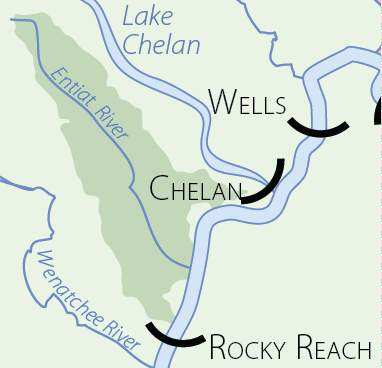
The Entiat subbasin is located along the eastern slopes of the Cascade Mountains in north-central Washington State, Chelan County. It comprises the Entiat and Mad River watersheds, collectively known as the Entiat subbasin, as well as some minor Columbia River tributary drainages. The subbasin is approximately 305,641 acres and bounded on the northeast by the Chelan Mountains and the Lake Chelan drainage; to the southwest are the Entiat Mountains and the Entiat River subbasin.
Key Findings: Aquatic
Spring chinook
Spring chinook production in the Entiat River could increase if habitat problems within the lower basin were rectified. Preservation of quality spawning and rearing habitat in the Middle Entiat AU is important to maintain naturally reproducing populations. Increases of off channel habitat and riparian areas in the lower Entiat River would increase potential rearing habitat and life history diversity. Creating or restoring habitat will increase spring chinook productivity by a modest degree, and increase the spatial and potential life history diversity within the Entiat River.
Late-run chinook
Late-run chinook production in the Entiat River could increase if habitat problems within the lower river were corrected. Increases of off channel habitat and riparian areas in the lower Entiat River would increase productivity by increasing potential rearing, adult holding habitat, and genetic, spatial, and life history diversity.
Steelhead trout
Steelhead production in the Entiat River could increase if habitat problems within the lower basin were rectified. Preservation of quality spawning and rearing habitat in the Mad and Middle Entiat AU is important to maintain naturally reproducing populations. Increases of off channel habitat and riparian areas in the lower Entiat River would increase potential rearing habitat and life history diversity. Creating or restoring habitat will increase steelhead productivity by a modest degree, and increase the spatial and potential life history diversity within the Entiat River.
Bull trout
Bull trout production in the Entiat River Basin could increase if habitat problems were rectified. Increases of off channel habitat and riparian areas in the lower Entiat River, would increase potential rearing and adult holding habitat and life history diversity. While creating or restoring habitat may not increase overall bull trout production by a significant degree, it does increase the spatial and potential genetic diversity of bull trout in the Entiat River. Bull trout are more sensitive than other species to habitat degradation. Water quality requirements for bull trout require the preservation and restoration of high functioning habitat. Processes that affect temperature, sediment load and connectivity from lower quality (feeding areas) to higher quality (spawning and initial rearing areas) should all be considered when trying to increase overall production of bull trout.
Westslope cutthroat trout
Westslope cutthroat trout are known to exist throughout most of the high elevation streams within the Entiat subbasin. There are concerns about the status of this species due to genetic introgression (especially with introduced rainbow trout), competition with non-native species (brook trout), depressed and fragmented populations or stocks, and loss of migratory life histories. Information addressing population abundance, trend and distribution is lacking.
Pacific lamprey
Pacific lamprey still exist in the Entiat system, but the abundance and distribution is mostly unknown. Due to the declining status of this species, and the lack of information a relatively high level of effort to monitor and enhance these populations are recommended.
Coho salmon
Coho salmon were extirpated from the Entiat River. Coho re-introduction into the Entiat River is being considered by fishery co-managers. Implemented of this work would likely proceed with relatively low levels of artificial production during a feasibility phase. Feasibility investigations would occur over several generations of returning fish (approximately 10-years).
Aquatic Monitoring and Infrastructure Needs
The monitoring plan draws from the existing regional strategies (Independent Scientific Advisory Board, Action Agencies/NOAA Fisheries, and Washington Salmon Recovery Funding Board) and outlines an approach specific to the Entiat Basin. The plan addresses the following basic questions:
What are the current habitat conditions and abundance, distribution, life-stage survival, and age- composition of ESA-listed fish in the Entiat Basin (status monitoring)?
How do these factors change over time (trend monitoring)?
What effects do tributary habitat actions have on fish populations and habitat conditions (effectiveness monitoring)?
The monitoring plan is designed to address these questions and at the same time eliminate duplication of work, reduce costs, and increase monitoring efficiency. The implementation of valid statistical designs, probabilistic sampling designs, standardized data collection protocols, consistent data reporting methods, and selection of sensitive indicators will increase monitoring efficiency. For this plan to be successful, all organizations involved must be willing to cooperate and freely share information. Cooperation includes sharing monitoring responsibilities, adjusting or changing sampling methods to comport with standardized protocols, and adhering to statistical design criteria. In those cases where the standardized method for measuring an indicator is different from what was used in the past, it may be necessary to measure the indicator with both methods for a few years so that a relationship can be developed between the two methods. Measurements generated with a former method could then be adjusted to correct for any bias.
The monitoring report is divided into seven major parts. The first part (Section 2) identifies valid statistical designs for status/trend and effectiveness monitoring. Section 3 discusses issues associated with sampling design, emphasizing how one selects a sample and how to minimize measurement error. Section 4 examines how sampling should occur at different spatial scales. Section 5 describes the importance of classification and identifies a suite of classification variables. Section 6 identifies and describes biological and physical/environmental indicators, while Section 7 identifies methods for measuring each indicator variable. These six sections provide the foundation for implementing an efficient monitoring plan in the Entiat Basin. The last section deals with how the program will be implemented. Section 8 provides a checklist of questions that need to be addressed in order to implement a valid plan.
At this time entities that collect information relevant to fish and wildlife interests in the Entiat subbasin do not have a centralized location to store or retrieve critical or timely information. Key questions yet to be addressed at the subbasin and Regional level concerns data management, data interpretation and data presentation. One of the significant challenges yet to be resolved is in describing the organizational and cooperative manner in which agencies and entities can integrate the regular collection and interpretation of natural resource information and provide this information to the public in a manner that allows full involvement in future decision making processes.
Subbasin Plan Download
![]() Subbasin plans are stored on the Northwest Power and Conservation Council’s website. All links will open on their website.
Subbasin plans are stored on the Northwest Power and Conservation Council’s website. All links will open on their website.
Entiat River Subbasin Plan (7 MB PDF)
Click here to go to the plan materials overview page.
Entiat River Subbasin
Entiat River Subbasin
Scenes from the Subbasin

Scenes from the Subbasin
Entiat River cobble bed.